Conditions are primed for a fierce hurricane season. Here's what to expect
Published in News & Features
FORT LAUDERDALE, Fla. — Another potentially dangerous hurricane season officially begins Sunday and with forecasters calling for an “above-average” number of storms, Floridians should have their initial preparations in place soon.
We can expect an above-average season over the next six months due to many factors, including hot Atlantic ocean temperatures.
It’ll be the latest busy season: Last year, Hurricane Helene became the most deadly U.S. hurricane since Katrina, and Hurricane Milton spawned some 43 tornadoes across the state.
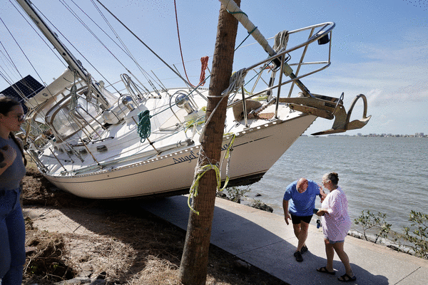
Floridians must stay vigilant: Our 8,000-mile-plus coast makes us a big target, and the storm-surge death rate is particularly high here. This year, the National Hurricane Center is rolling out new forecast tools to help the public prepare.
As the season officially begins this weekend and lasts for six months, here’s everything you need to know.
How many hurricanes will 2025 bring?
This hurricane season is expected to bring more named storms as well as more hurricanes and major hurricanes. As for the odds, there’s a 60% chance of an above-normal season and a 10% chance of a below-normal season, said Ken Graham, director of the National Weather Service.
The National Oceanic and Atmospheric Administration is calling for 13 to 19 named storms, with sustained winds of 39 mph or more.
Colorado State University predicted 17 named storms in its annual spring hurricane outlook. Last year had 18.
The average from 1991 to 2020 was 14.
Six to 10 of those named storms likely will become hurricanes, with maximum sustained surface winds of 74 mph or greater, NOAA said.
Last year had 11 hurricanes (the average year has seven), five of which made landfall in the continental U.S., resulting in 297 deaths.
NOAA expects three to five major hurricanes, meaning they’ll be Category 3 or above with sustained winds of 111 mph or greater.
CSU hurricane researchers predicted that the 2025 hurricane season will be about 25% more active than the average season.
Last season’s hurricane season was about 30% more active than the average season.
Forces and factors
Graham said that three factors inform the forecast: Warm sea-surface temperatures in the Atlantic Basin, a lack of wind shear over the region, and a forecast for strong African monsoons, which can roll off the continent and fuel tropical storms once over the Atlantic.
“Everything is in place for an above-average season,” Graham said.
The heat behind the forecast: Above-average sea surface temperatures in the eastern subtropical Atlantic Ocean and Caribbean Sea are primary factors for this year’s storm season, according to researchers at Colorado State University.
Matt Rosencrans, of the National Hurricane Center, said that sea-surface temperatures right now are about as warm as they usually are in late June. But last year at this time they were as warm as they normally would be in August.
Hotter-than-normal, sea-surface temperatures work in two ways, according to the researchers. First, they generally fuel hurricane formation.
Secondly, when spring sea-surface temperatures are high in the eastern Atlantic, as they are now, it tends to mean weaker trade winds across the Atlantic.
Flat, calm water heats up faster — above-average water temperatures will likely continue for the peak of the 2025 hurricane season.
“Additionally, a warm Atlantic leads to lower atmospheric pressure and a more unstable atmosphere. Both conditions favor hurricane formation,” the report said.
La Niña and El Niño impacts: NOAA and CSU forecasters also point to a lack of El Niño as being conducive to storms. El Niños usually ramp up wind shear, which can cripple storms.
“Given the combined hurricane-favorable signals of a warm Atlantic and the unlikelihood of El Niño, the CSU forecast team is predicting an above-normal season,” a report said.
Trends to know
Since the 1990s, we’ve been in a “high-activity era” for hurricanes, said Michael Brennan, director of the National Hurricane Center.
The background conditions that have driven that trend are warmer-than-normal ocean temperatures.
Florida accounted for 410 of the 660 hurricane-related deaths in the U.S. since 2017. As a peninsula with 8,436 miles of shoreline, second only to Alaska, we’re a big target.
The fatality stats have motivated NOAA to focus on water hazards as much as wind.
Nationally, water, both freshwater flooding and saltwater storm surge, has been responsible for 63% of the direct fatalities from hurricanes in the past decade, said Brennan. Wind accounts for only about 20%. Surf and rip currents account for 11%.
But Florida is different. Almost half of the direct fatalities are from storm surge. In 2017, NOAA introduced storm-surge warnings.
Post-storm indirect deaths, which are nearly as high as direct deaths and affect the elderly more than other groups, stem from car accidents, lack of medical access, recovery accidents, cardiac arrest, heat fatalities and carbon monoxide poisoning from faulty generator use.
New for 2025
The National Hurricane Center is rolling out some new forecast features, and making an experimental map operational.
Experimental map: Last year it rolled out an experimental, more detailed version of the cone graphic. The detailed version shows inland tropical storm and hurricane watches and warnings, because destruction is not limited to the coast.
An example of how the detailed version works played out last year when, during Hurricane Helene, nearly the entire state of Florida was covered by hurricane and tropical storm warnings and a hurricane warning that extended hundreds of miles into Georgia. It turned out to be the deadliest U.S. hurricane since Katrina.
Rip current risk map: NOAA’s National Hurricane Center also is debuting a rip current risk viewer map. Florida has had the most rip current-related deaths of any state since 2013, in part because storms off the east coast can create dangerous swells 1,000 miles away on Florida’s beaches, said Brennan. Deadly rip currents on Florida’s east coast can occur on an otherwise nice day, he said.
Longer lead times: The National Hurricane Center also is offering forecasts with longer lead times. Previously, potential tropical cyclone advisories were released 48 hours prior to expected arrival of impacts. The lead time will now be 72 hours. This means longer lead times when forecasters feel confident that wind and storm surge will significantly impact land areas.
A potential tropical cyclone is a disturbance that is not yet a tropical storm with sustained winds of 39 mph or greater, but it’s strong enough to bring tropical storm and hurricane conditions to land areas.
Heat risk: Post-storm deaths can be driven by the combination of hot weather and lack of air conditioning, especially for the elderly. The National Hurricane Center also is launching post-storm heat risk maps that integrate heat forecasts with potential for power loss.
Key reminders
Robert Molleda of the NWS’s Miami office reminded the public that watches and warnings are more effective than merely concerning oneself with the cone.
He said that with storm surge and hurricanes, a watch means hurricane conditions and life-threatening surge are possible within 48 hours. A warning means they are expected within 36 hours.
He mentioned that last year, Hurricane Milton, which made landfall on Florida’s west coast, spun up 43 known tornadoes, many of which were on the east coast. He said the front right-hand side of a hurricane is where tornadoes can form, even if the eye is 100 or 200 miles away.
Any tropical system can cause tornadoes, even weak and disorganized ones.
At a hurricane preparedness meeting, Chuck Lanza, director of Broward county office of emergency management, outlined how to make a family emergency plan:
—Choose a safe place to meet.
—Learn evacuation routes now.
—Evacuation does not mean driving upstate, he said. “You don’t have to leave the county, you just have to leave the evacuation zone.”
—Establish an out-of-town contact.
—Talk to children about what to do before, during and after an emergency.
—Make plans for pets. Be prepared to show proof of rabies vaccination for cats and dogs at Broward County shelters, and bring a pet crate if you have one.
—Inventory your home with video and photos. Make paper copies of important documents such as birth certificates and insurance policies.
—Everyone should have food, water and emergency supplies to last three to five days without power.
—You can sign up for Broward County emergency alerts at Broward.org/Emergency.
—If you have questions, call the Broward call center at 311.
Graham, of the National Weather Service, encouraged people to take hurricanes seriously.
“There’s no such thing as just a Cat 1, just a Cat 2 storm,” he said. “Even a small storm is a danger.” Now is a good time to prepare for hurricane season, he said. “There are no lines today.”
Rep. Debbie Wasserman Schultz, D-Fla., who recently held a hurricane preparedness meeting in Hallandale Beach, said, “People absolutely must get ready in advance of the start of hurricane season. You should have your go-kits ready, you should have your 72 hours, really up to a week’s worth of supplies already stocked in your home. … Don’t wait. That’s the bottom line.”
Hurricane season ends Nov. 30.
©2025 South Florida Sun Sentinel. Visit at sun-sentinel.com. Distributed by Tribune Content Agency, LLC.


Comments